
 Camping
sites: Next to Owen Creek – Next to Cataract Creek in White Goat WA –
Four Point Creek CG in Jasper NP – Mary Vaux CG in Jasper NP – Curator
CG in Jasper NP - Jasper
Camping
sites: Next to Owen Creek – Next to Cataract Creek in White Goat WA –
Four Point Creek CG in Jasper NP – Mary Vaux CG in Jasper NP – Curator
CG in Jasper NP - JasperRoute: David Thompson Highway – Owen Creek – Unnamed Pass – Highest point on GDT –pass – Pinto Lake – Cataract Creek – Cataract Pass

 It was
time to play hide and seek with the trail again. At first following Owen
Creek and climbing was easy, though it was cold and rainy. When we got
higher it was even hailing and snowing a bit, but after a few hot days
we welcomed the cool air. After the trail disappeared once more and we
did the steep and long climb without it. And what a beautiful pass it
was!
It was
time to play hide and seek with the trail again. At first following Owen
Creek and climbing was easy, though it was cold and rainy. When we got
higher it was even hailing and snowing a bit, but after a few hot days
we welcomed the cool air. After the trail disappeared once more and we
did the steep and long climb without it. And what a beautiful pass it
was! 


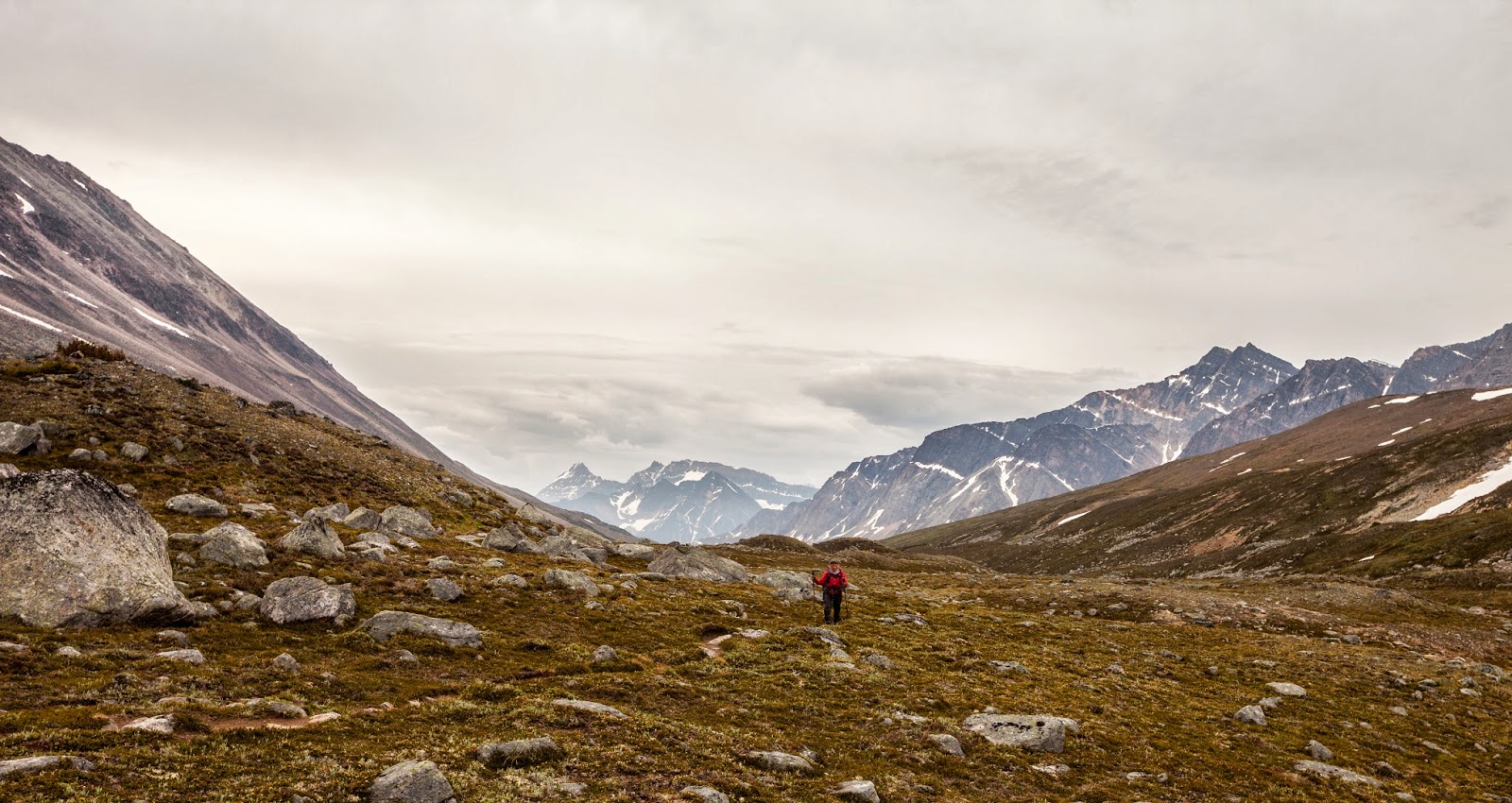
Then before we even noticed we were at the highest point on the GDT (2590 m) trying to keep our stuff from flying with a battering wind while we took a picture to proof this achievement. Next pass offered the most challenging climb we faced during the hike. The wall at the end was just a few meters high but so icy it was hard to find footings that held.


|
| The highest point on our hike (2590 m) and it was windy |


 After
the passes we improvised and found our own way on the hills without the
trail. When approaching Pinto Lake we were finally able to spot a nice
and clean trail that helped to appreciate the beauty of the lake even
more. Of course it felt like a huge set back when we lost the tracks
again and faced another afternoon in the bush.
After
the passes we improvised and found our own way on the hills without the
trail. When approaching Pinto Lake we were finally able to spot a nice
and clean trail that helped to appreciate the beauty of the lake even
more. Of course it felt like a huge set back when we lost the tracks
again and faced another afternoon in the bush.


Pinto Lake
 |
| The last fight of the day: Crossing Cataract River, took us a couple of hours |
Route: Four Point Creek – Jonas Pass – Jonas Shoulder – Poboktan Creek – Poligne Creek – Maligne Pass – Maligne River – Trapper Creek – Maligne Lake – Evelyn Creek – Little Shovel Pass – Big Shovel Pass – Curator Lake – The Notch – Amber Mountain – Maligne Lake Road – Bighorn Trail – Jasper
 Reaching
Cataract pass meant entering Jasper National park where the trail was
easy to follow and in good shape, what a treat and highly appreciated!
Cataract Pass was a long pass that took us through snow and rocks again
but also offered an amazing view to huge gorgeous alpine tundra areas
that we later hiked on.
Reaching
Cataract pass meant entering Jasper National park where the trail was
easy to follow and in good shape, what a treat and highly appreciated!
Cataract Pass was a long pass that took us through snow and rocks again
but also offered an amazing view to huge gorgeous alpine tundra areas
that we later hiked on.


We still faced some bushy areas and wet muskegs on the way but nothing too bad. It felt great to be able to speed up and make some real progress with kilometers.


It is easy to hike when you are on a hiker's highway


 | |||||||
| Happy hikers |


 |
| Crossing the dreaded Maligne River without any problems |
 |
| It has been long time since we've seen bridges like this |
 |
| Some bushes also in Jasper |


It was amazing to be able to hike fast and it was obvious hiking on a good trail saves some energy for enjoying the views and using the camera.
We finished this leg of the hike by rushing through the Skyline trail that is said to be one of the best backpacking routes in the Canadian Rockies. It is a perfectly maintained, 44 km highway trail with 1928 m of elevation gain and it just felt so easy after spending our time in the bush for a few days. We hiked on huge alpine tundra areas that were extremely beautiful. Meeting so many other hikers was a minor culture shock but we knew we would be alone again soon.


 |
| On the top of the Notch |


Arriving in Jasper was awesome and felt even better than reaching Banff. We celebrated it by swimming in a lake near town.
It was unbelievable to finally arrive in Jasper and realize over 900 km of the hike were already done. We enjoyed well deserved good dinner and lots of different treats and updated our gear with new shoes for Piia and rain cover for Julien.
 |
| Julien enjoying some treats |
 |
| Time to buy new ones? |
No comments:
Post a Comment